


Быстрая навигация
- Истории
- События
-
Журнал
- История фотографии
- Персона
- Личный опыт
- Вдохновение и мотивация
- Споры и этические дилеммы
- Культурное видение
- Право и бизнес
- За кулисами
- Форумы
-
Блоги
- Все Блоги
- Создать Блог
- Пользователи
- Вход
Updates on map locations and location selection 🗺
Форумы / Help / Website Updates
We are pleased to announce a dedicated thread to keep you updated on the latest changes and improvements regarding locations on our project.
New Location Added: Lofoten Islands
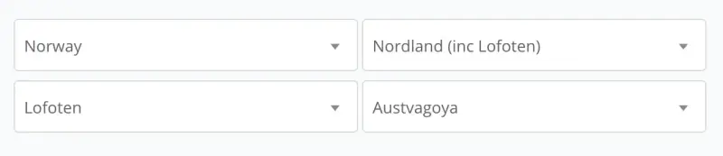
We’re excited to announce that the Lofoten Islands have been added to the geolocation options on our platform!
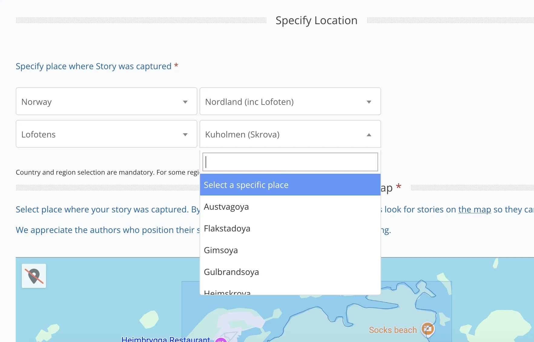
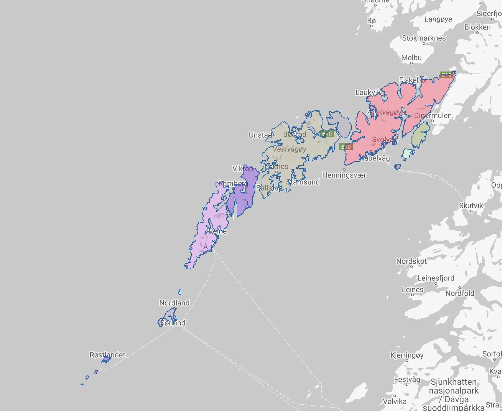
This update includes not only the entire archipelago but also each of its major islands individually. You can now select and explore the following islands as separate locations:
- Austvågøya
- Gimsøya
- Vestvågøya
- Flakstadøya
- Moskenesøya
- Røstlandet
- Værøy
- + 10 more
These stunning islands are a treasure trove of natural beauty, perfect for photography enthusiasts. Whether you're interested in majestic fjords, iconic fishing villages, or dramatic landscapes, Lofoten has it all. For those interested in working with geospatial data, the boundaries of the Lofoten Islands are now available for download as a GeoJSON file. Additionally, we provide a separate GeoJSON file with the boundaries of each island individually — perfect for your own projects and mapping needs

We look forward to seeing your stories and photos from this remarkable destination! Stay tuned for more updates on new locations!
0
0
New Location Added: Canary Islands
We’re excited to announce that the Canary Islands have been added to the geolocation options on our platform!
Situated in the Atlantic Ocean, the Canary Islands have plenty to recommend to visitors. But perhaps the most outstanding feature of this cluster of islands, whose people have their own distinctive accent and vocabulary, is that the climate remains mild and warm throughout the year. However, Canary Islands’ weather can sometimes change without warning in certain areas and at certain altitudes.
There are seven islands: Tenerife, Gran Canaria, Lanzarote, Fuerteventura, La Palma, La Gomera and El Hierro. They vary in size, and each has its own distinct character.
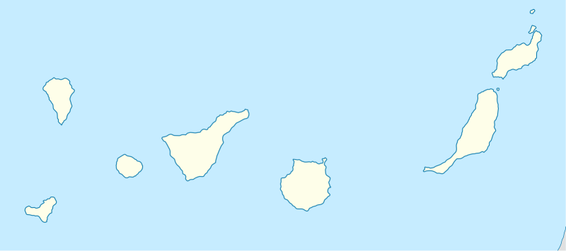
For those interested in working with geospatial data, the boundaries of the Canary Islands are now available for download as a GeoJSON file. Additionally, we provide a separate GeoJSON file with the boundaries of each island individually — perfect for your own projects and mapping needs
GeoJSON file for all Tenerife sublocations
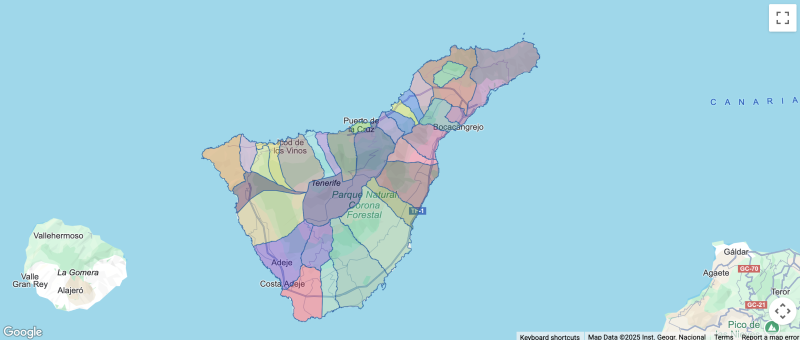
- Tenerife
- Adeje
- Arafo
- Arico
- Arona
- Buenavista del Norte
- Candelaria
- El Rosario
- El Sauzal
- El Tanque
- Fasnia
- Garachico
- Granadilla de Abona
- Guia de Isora
- Icod de los Vinos
- La Guancha
- La Matanza de Acentejo
- La Orotava
- La Victoria de Acentejo
- Los Silos
- Puerto de la Cruz
- San Cristobal de La Laguna
- San Juan de la Rambla
- San Miguel de Abona
- Santa Cruz de Tenerife
- Santa Ursula
- Santiago del Teide
- Tacoronte
- Tegueste
- Vilaflor
- Gueimar
- Los Realejos
GeoJSON file for all Lanzarote sublocations
- Lanzarote
- Arrecife
- Haria
- San Bartolome
- Teguise
- Tias
- Tinajo
- Yaiza
GeoJSON file for all La Palma sublocations
- La Palma
- Barlovento
- Brena Alta
- Brena Baja
- Fuencaliente de La Palma
- Garafia
- Los Llanos de Aridane
- El Paso
- Puntallana
- Puntagorda
- Tazacorte
- San Andres y Sauces
- Santa Cruz de La Palma
- Tijarafe
- Villa de Mazo
GeoJSON file for all La Gomera sublocations
- La Gomera
- Vallehermoso
- Agulo
- Valle Gran Rey
- Alajero
- Hermigua
- San Sebastian de la Gomera
GeoJSON file for all Gran Canaria sublocations
- Gran Canaria
- Agueimes
- Agaete
- Artenara
- Arucas
- Firgas
- Galdar
- Ingenio
- Las Palmas de Gran Canaria
- Mogan
- Moya
- San Bartolome de Tirajana
- Santa Lucia de Tirajana
- La Aldea de San Nicolas
- Santa Maria de Guia de Gran Canaria
- Santa Brigida
- Tejeda
- Telde
- Teror
- Valleseco
- Valsequillo de Gran Canaria
- Vega de San Mateo
GeoJSON file for all Fuerteventura sublocations
- Fuerteventura
- Antigua
- Betancuria
- La Oliva
- Pajara
- Puerto del Rosario
- Tuineje
GeoJSON file for all El Hierro sublocations
- El Hierro
- El Pinar de El Hierro
- Valverde
- Frontera
0
New Location Added: Balearic Islands
The Balearic Islands are an autonomous community of Spain, formed by the Balearic Islands Province.
The main islands are Mallorca (English: Majorca), Minorca, Ibiza (also called Eivissa) and Formentera.
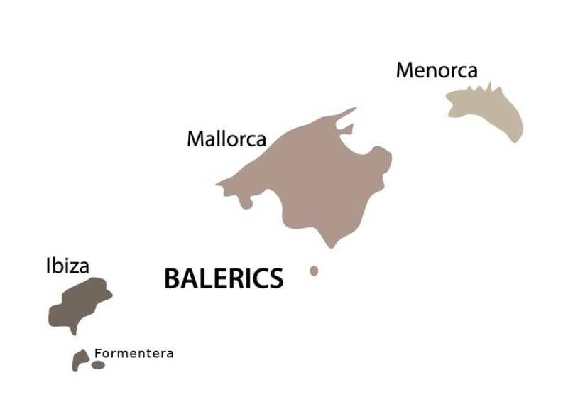
For those interested in working with geospatial data, the boundaries of the Balearic Islands are now available for download as a GeoJSON file. Additionally, we provide a separate GeoJSON file with the boundaries of each island individually — perfect for your own projects and mapping needs
- Balearic Islands
- Majorca
- Ibiza
- Formentera
- Menorca
0
We’ve just updated the Germany data — major cities and towns are now added for each federal state.
This includes key urban areas like Hamburg-Mitte, Altona, Berlin-Mitte, Friedrichshain-Kreuzberg, and many more across all 16 Bundesländer.
This should make regional browsing and content tagging much easier for anyone focusing on German locations.
Feel free to suggest corrections or missing places — your feedback is welcome!
- Schleswig-Holstein
- Kiel
- Luebeck
- Flensburg
- Neumuenster
- Norderstedt
- Elmshorn
- Pinneberg
- Itzehoe
- Wedel
- Ahrensburg
- Henstedt-Ulzburg
- Reinbek
- Geesthacht
- Bad Oldesloe
- Schleswig
- Saxony-Anhalt
- Halle (Saale)
- Magdeburg
- Dessau-Rosslau
- Wittenberg
- Stendal
- Weissenfels
- Halberstadt
- Sangerhausen
- Merseburg
- Bernburg
- Naumburg (Saale)
- Quedlinburg
- Schonebeck
- Aschersleben
- Bitterfeld-Wolfen
- Saxony
- Leipzig
- Dresden
- Chemnitz
- Zwickau
- Plauen
- Gorlitz
- Freiberg
- Bautzen
- Radebeul
- Pirna
- Hoyerswerda
- Meissen
- Glauchau
- Limbach-Oberfrohna
- Grimma
- Saarland
- Saarbruecken
- Neunkirchen
- Homburg
- Voelklingen
- Sankt Ingbert
- Saarlouis
- Merzig
- St. Wendel
- Dillingen
- Lebach
- Bexbach
- Blieskastel
- Ottweiler
- Pirmasens
- Wadern
- Rhineland-Palatinate
- Mainz
- Ludwigshafen
- Koblenz
- Trier
- Kaiserslautern
- Worms
- Neuwied
- Frankenthal
- Pirmasens
- Speyer
- Bad Kreuznach
- Landau
- Andernach
- Zweibruecken
- Idar-Oberstein
- North Rhine-Westphalia
- Cologne
- Dusseldorf
- Dortmund
- Essen
- Duisburg
- Bochum
- Wuppertal
- Bielefeld
- Bonn
- Muenster
- Gelsenkirchen
- Aachen
- Moenchengladbach
- Krefeld
- Oberhausen
- Lower Saxony
- Hanover
- Braunschweig
- Osnabrueck
- Oldenburg
- Wolfsburg
- Goettingen
- Salzgitter
- Hildesheim
- Wilhelmshaven
- Delmenhorst
- Celle
- Garbsen
- Lueneburg
- Emden
- Goslar
- Mecklenburg-Western Pomerania
- Rostock
- Schwerin
- Neubrandenburg
- Stralsund
- Greifswald
- Wismar
- Guestrow
- Waren
- Parchim
- Ludwigslust
- Boizenburg
- Ueckermuende
- Teterow
- Malchow
- Bergen auf Ruegen
- Hesse
- Frankfurt am Main
- Wiesbaden
- Darmstadt
- Kassel
- Offenbach
- Hanau
- Giessen
- Fulda
- Marburg
- Ruedesheim
- Bad Homburg
- Wetzlar
- Limburg
- Bad Hersfeld
- Baunatal
- Hamburg
- Hamburg-Mitte
- Altona
- Eimsbüttel
- Hamburg-Nord
- Wandsbek
- Bergedorf
- Harburg
- Bremen
- Bremen
- Bremerhaven
- Brandenburg
- Potsdam
- Brandenburg an der Havel
- Cottbus
- Frankfurt (Oder)
- Oranienburg
- Falkensee
- Eberswalde
- Senftenberg
- Bernau
- Neuruppin
- Forst
- Koenigs Wusterhausen
- Luckenwalde
- Schwedt
- Wittenberge
- Berlin
- Mitte
- Friedrichshain-Kreuzberg
- Pankow
- Charlottenburg-Wilmersdorf
- Spandau
- Steglitz-Zehlendorf
- Tempelhof-Schöneberg
- Neukölln
- Treptow-Köpenick
- Marzahn-Hellersdorf
- Lichtenberg
- Reinickendorf
- Bavaria
- Munich
- Nuremberg
- Augsburg
- Regensburg
- Wuerzburg
- Ingolstadt
- Fuerth
- Rosenheim
- Schweinfurt
- Erlangen
- Bayreuth
- Aschaffenburg
- Neu-Ulm
- Passau
- Landshut
- Baden-Wuerttemberg
- Stuttgart
- Mannheim
- Karlsruhe
- Freiburg
- Heidelberg
- Ulm
- Heilbronn
- Pforzheim
- Reutlingen
- Esslingen
- Ludwigsburg
- Schwaebisch Gmuend
- Tuebingen
- Aalen
- Villingen-Schwenningen
0
New Location Added: Cappadocia (Protected Area Kapadokya) with Goreme Historical National Park, Nevsehir Province, Turkey
Goreme Historical National Park, Goreme Open Air Museum, Uchisar Castle, Ortahisar Castle, Zelve Open Air Museum, Pigeon Valley, Love Valley, Rose Valley, Paşabağ Vadisi, Three Beauties (Uc Guzeller), Red Valley
We look forward to seeing your stories and photos from this remarkable destination! Stay tuned for more updates on new locations!
0
New Location Added: Archipelago Santorini
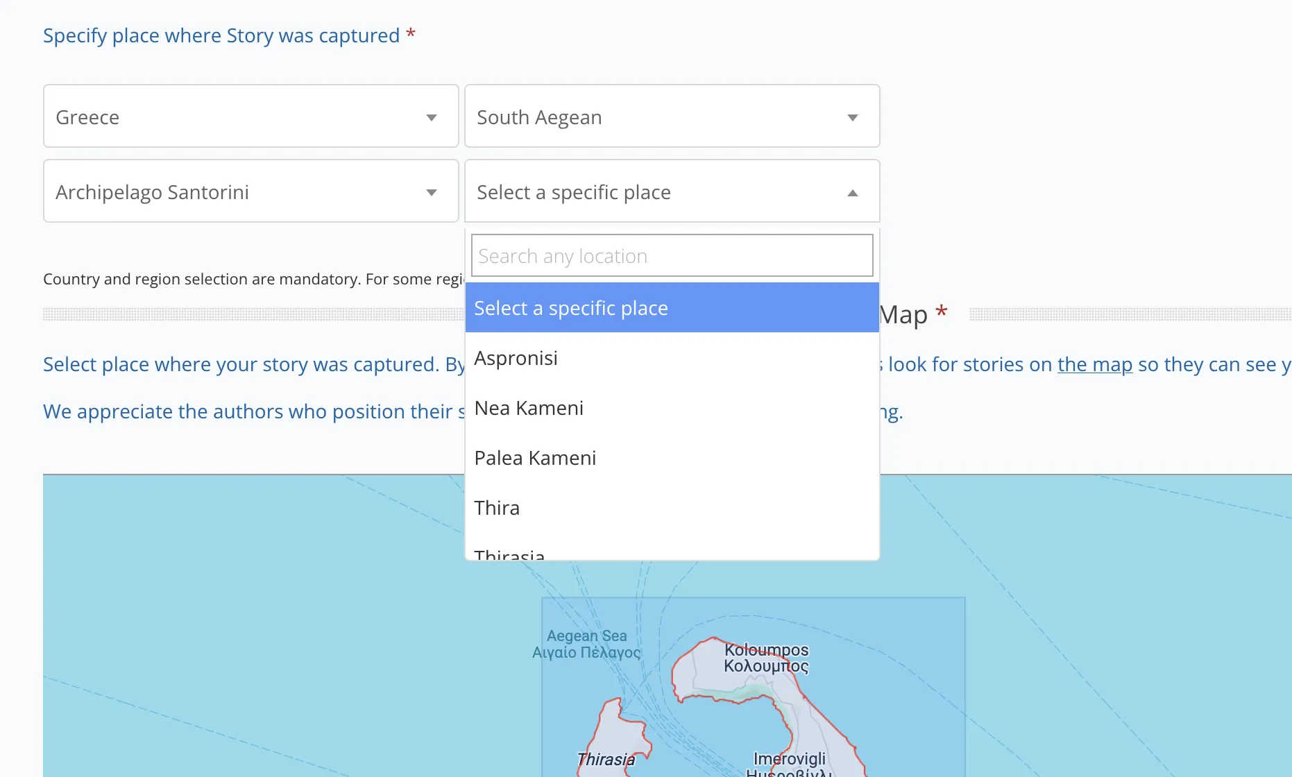
This update includes not only the entire archipelago but also each of its major islands individually. You can now select and explore the following islands as separate locations:
- Thirasia
- Nea Kameni
- Palea Kameni
- Aspronisi
- Thira
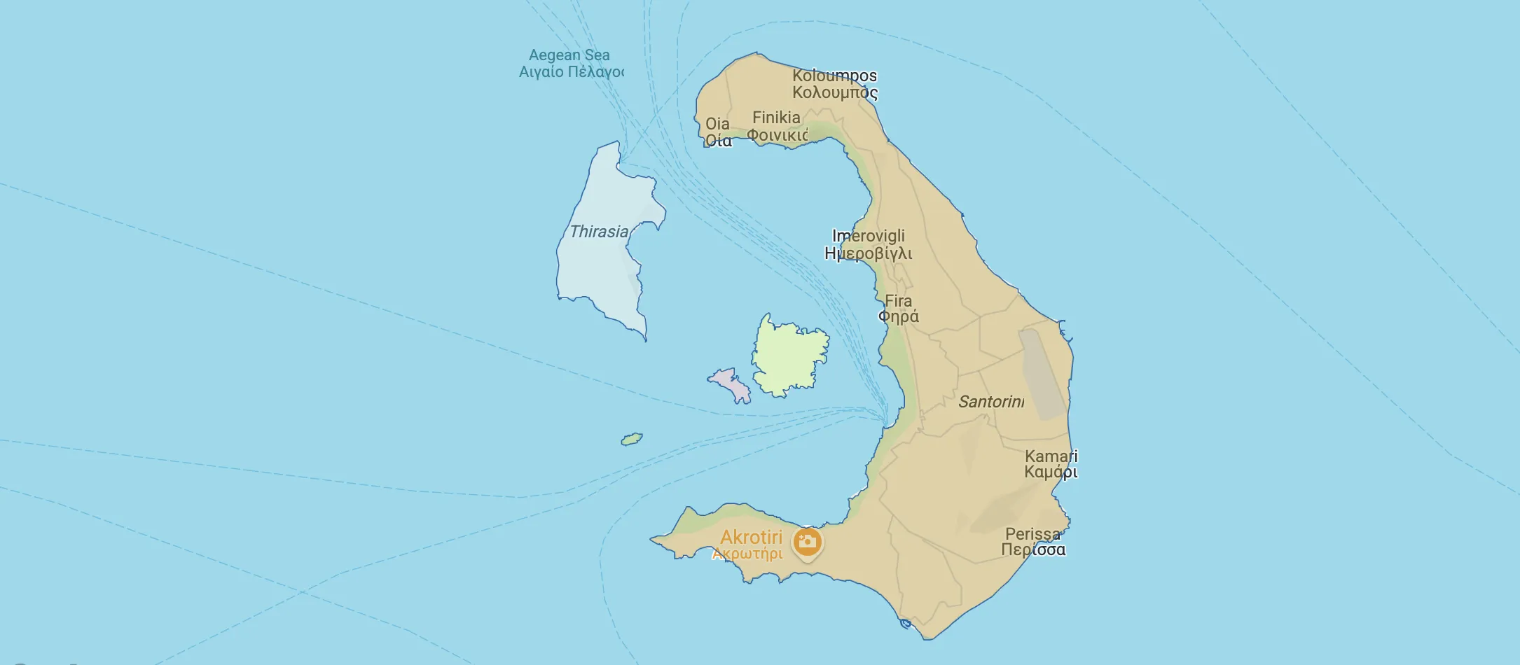
For those interested in working with geospatial data, the boundaries of the Archipelago Santorini are now available for download as a GeoJSON file. Additionally, this file includes the boundaries of each island individually as a separate layer — perfect for your own projects and mapping needs
0
New Location Added: Azores Islands, Portugal
We’re excited to announce that the Azores Islands have been added to the geolocation options on our platform!
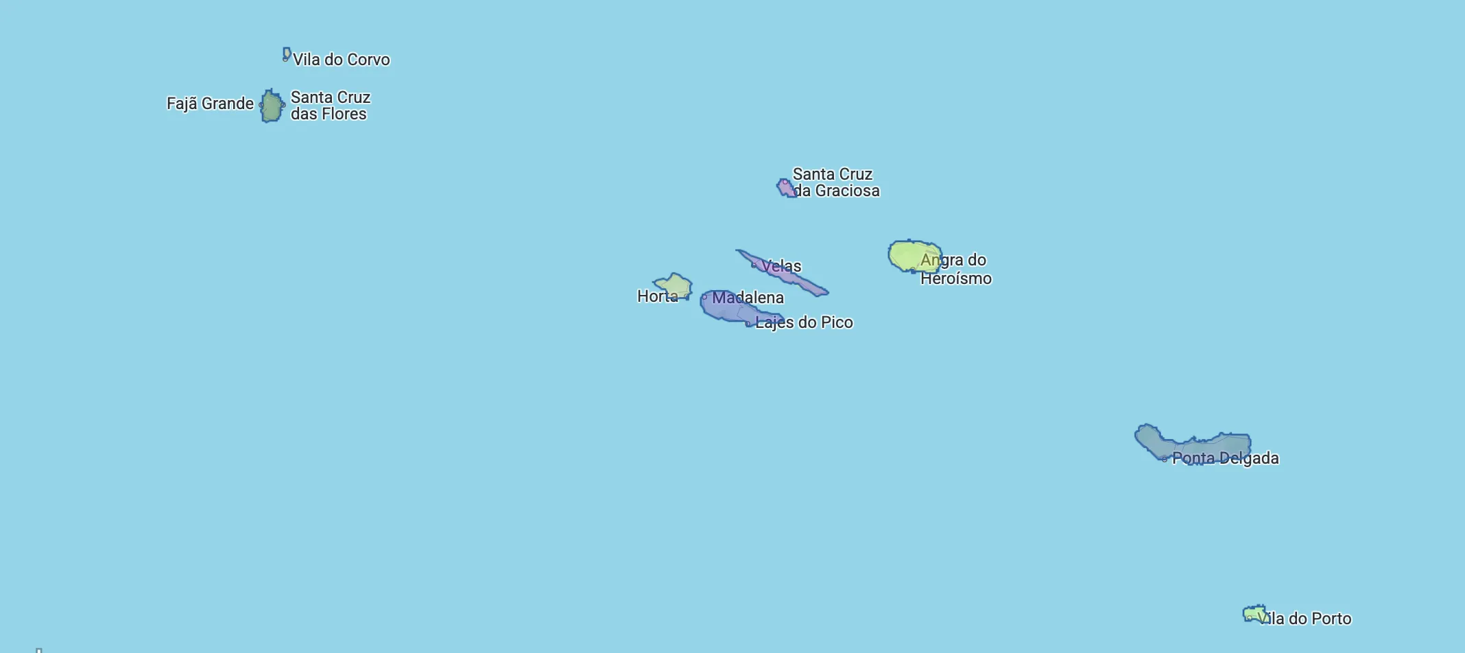
This update includes not only the entire region but also each of its major islands individually. You can now select and explore the following islands as separate locations: Flores, Corvo, Faial, Pico, Sao Jorge, Graciosa, Terceira, Sao Miguel, Santa Maria.
For Sao Miguel island added cities Ponta Delgada and Ribeira Grande, and natural attractions: Reserva Natural da Lagoa do Fogo, Caldeira Velha, Furnas, Sete Cidades.
For those interested in working with geospatial data, the boundaries of the Azores Islands are now available for download as a GeoJSON file. Additionally, this file includes the boundaries of each island individually as a separate layer — perfect for your own projects and mapping needs
New Location Added: Madeira Islands, Portugal
We’re excited to announce that the Madeira Islands have been added to the geolocation options on our platform!
This update includes not only the entire region but also each of its major islands individually. You can now select and explore the following islands as separate locations: Madeira Island, Desertas Islands, Ilhas Selvagens and Porto Santo Island.
For those interested in working with geospatial data, the boundaries of the Madeira Islands are now available for download as a GeoJSON file. Additionally, this file includes the boundaries of each island individually as a separate layer — perfect for your own projects and mapping needs
0
New Location Added: Svalbard and Jan Mayen, Norway
We’re excited to announce that the Arctic archipelago of Svalbard has been added to the geolocation options on our platform!
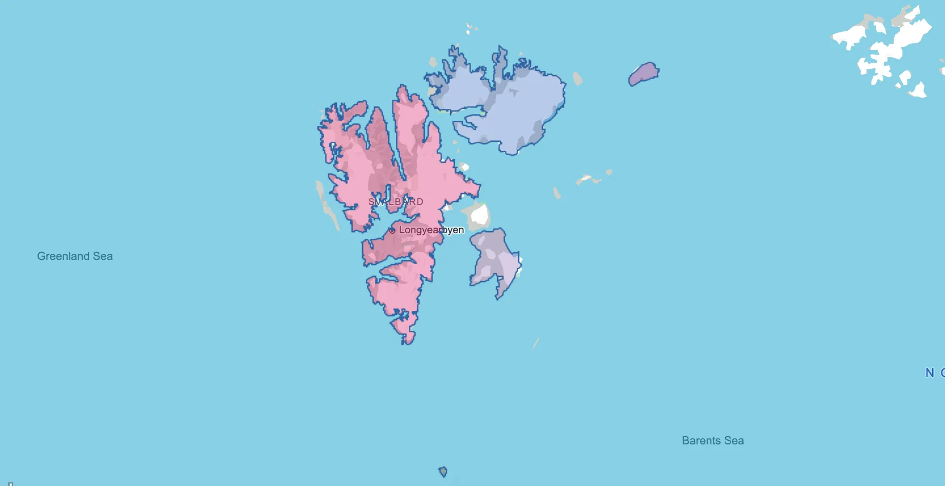
This update includes not only the entire Svalbard region but also each of its major islands as separate selectable locations: Spitsbergen, Bjørnøya (Bear Island), Nordaustlandet, Edgeøya (Edge Island), and Kvitøya (White Island).
For those working with maps or spatial data, a detailed GeoJSON file with the boundaries of Svalbard is now available.
This file includes individual layers for each of the islands — making it ideal for geographic projects, data visualization, or environmental research.
Explore the high Arctic like never before — from the glaciers of Spitsbergen to the remote shores of Bjørnøya!
0
New Location Added: Galápagos Islands, Ecuador
We’re thrilled to announce the addition of the Galápagos Islands to our platform’s geolocation options!
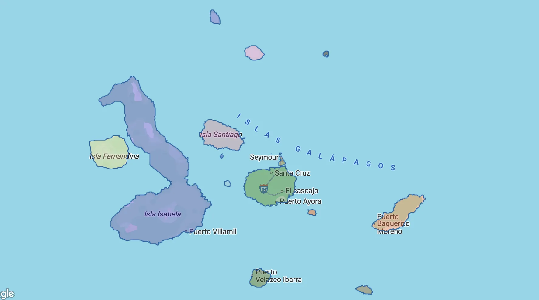
This iconic Pacific archipelago, part of Ecuador, is now fully mapped and available for selection. The update includes not only the region as a whole but also each of its major and minor islands as individual locations:
Isabela (Albemarle), Santa Cruz (Indefatigable), San Cristobal (Chatham), Española (Hood), Floreana (Charles or Santa María), Genovesa (Tower), Marchena (Bindloe), North Seymour, Baltra, Bartolome (Bartholomew), Darwin (Culpepper), Fernandina (Narborough), Pinzon (Duncan), Pinta (Louis), Rabida (Jervis), Santa Fe (Barrington), Santiago (San Salvador James), Wolf (Wenman).
For geospatial projects, a comprehensive GeoJSON file is now available. It includes boundary data for each island as separate layers — perfect for ecological mapping, educational use, and conservation analysis.
0
We’ve just updated the USA data — major islands, lakes and parks are now added for Alaska state.
Lake Louise, Denali National Park, Glacier Bay National Park, St. Lawrence Island, Nunivak Island, Nelson Island, Kigigak Island, Kodiak Island, Afognak Island, Uganik Island, Raspberry Island, Whale Island, Unimak Island, Unalaska Island, Akutan Island, Akun Island, Avatanak Island, Tigalda Island, Ugamak Island, Umnak Island, Chuginadak Island, Yunaska Island, Saint Matthew Island, Teshekpuk Lake
Feel free to suggest corrections or missing places — your feedback is welcome!
0
Feel free to share your suggestions on which locations you'd like to see added next or improved. Your feedback is invaluable in shaping our project!
Stay tuned for regular updates.